

In Rarioa, Near Kon-Tiki's Landing Place
Made the Jump to Makemo
We Saw the Total Eclipse!!!
Waiting for The Total Eclipse of the Sun
Back in Tahanea, Chainhook Recovered
South Fakarava Revisited
In Fakarava Provisioning
The Crown of Thorns' Revenge
Summary of Diving in Anse Amyot, Toau
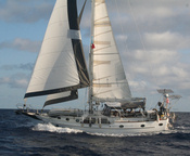
Anchored off the Kon-Tiki Monument, which is located at position: 16°03.873'S 142°21.548'W
Armed with a photo that our friend Jim resized and emailed us, from the article about the monument dedication, we finally located the monument. Of course, it is the only islet within a mile in either direction that we hadn't set foot on, it is the first one south of our first anchorage--which Dave had decided was too far north.
There is a nice plaque on the 'pile of rocks', and people have put shells and flowers on the 'altar'. It's very nice.
Even in the 3 years that have intervened since the photo was taken, the tree topography has changed--the most prominent palm tree in the picture--the tall one on the left--is no longer there. But with the amount of other non-palm vegetation in the picture, it was obvious that this had to be the island.
The waypoint that Jim found on the internet for Kon-Tiki is 16°04.649'S 142°21.980'W. The only thing that doesn't match up is that this waypoint is 8/10's of a mile from the island. The book says they camped on an island 600-700 yards north of the Kon-Tiki, which is more like a third of a mile. So we're not sure exactly which is right.
-----
At 7/25/2010 9:19 PM (utc) our position was 16°03.85'S 142°21.68'W
----------
radio email processed by SailMail
for information see: http://www.sailmail.com
Labels: Tuamotus
or Posts by Topic links in the upper left!
For all our 2009 posts see Soggy Paws 2009
For posts prior to 2009 (all our Caribbean travels) see
Soggy Paws 2007 & 2008
Hawaii
Marquesas
Tuamotus
Gambier Islands
Pitcairn Island
Easter Island
Galapagos
Ecuador
On Passage
Fishing
Diving
Maintenance
Electronics
Galley
Cocos Island
Ecuador
Ecuador Inland
Chile Inland
Peru Inland
French Canal Boat
USA 2009
On Passage
Fishing
Diving
Maintenance
Electronics
Intracoastal Waterway
Florida Keys
Dry Tortugas
Belize
Belize Inland
Guatemala
Guatemala Inland
USA 2007
Honduras
Islands Honduras->Panama
Panama-Carib Side
Colombia
Colombia Inland
Panama Canal
Panama-Pacific Side
Costa Rica
USA 2008
On Passage
Fishing
Diving
Maintenance
Provisioning
The Blog Template is generated via PsycHo and is Licensed.